





NWS Forecast
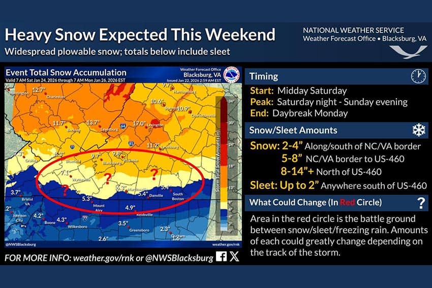 A high impact winter storm moves in Saturday afternoon, bringing snow/sleet/freezing rain through Monday morning. Heavy snow will fall along/north of US-460, up to a foot or more in the Shenandoah Valley, with 5-8″ south of US-460 to the NC/VA state line and lighter amounts in NC.
Sleet will mix in to the south, significantly cutting snow totals down to only a few inches in NC. Freezing rain will cause ice of around a quarter inch in the Piedmont, with a glaze to a tenth possible area-wide.
Brutal cold moves in following the storm, keeping travel treacherous for early next week.