




NWS Severe Weather Update
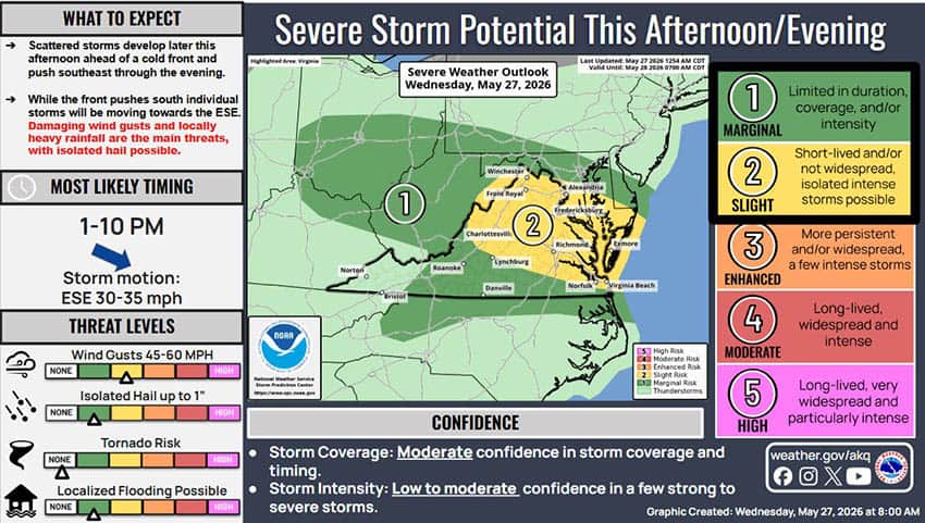
Threats: Storms this afternoon and evening could produce damaging wind gusts and large hail. The heaviest storms could cause localized flash flooding in urban, low-lying, and flood-prone areas.
Location: Severe threat for damaging winds exists across most of the area. The large hail threat is greatest in the northern Virginia Piedmont, north of Lynchburg along the I-64 corridor, and into northern and eastern VA. The flash flooding threat is state-wide.
Timing: 1pm- 10pm. Storms will be most prominent during the afternoon and evening hours today.
Overview and Impacts: Heavy rainfall from showers and storms could lead to localized flash flooding.
High rainfall rates: Stronger storms may produce rainfall at rates exceeding 3 inches per hour. Storms may also pass repeatedly over the same locations.
Urban flooding: Ponding of water on roadways, flooding of low-lying, paved, and poor drainage areas.
Small rivers and streams: Rapid water rises taking small rivers and streams out of their banks, especially near low water crossings.
Strong storms could cause damaging wind gusts of 60+ mph which could lead to downed trees and powerlines and cause localized power outages. Large hail could damage roofs and cars.